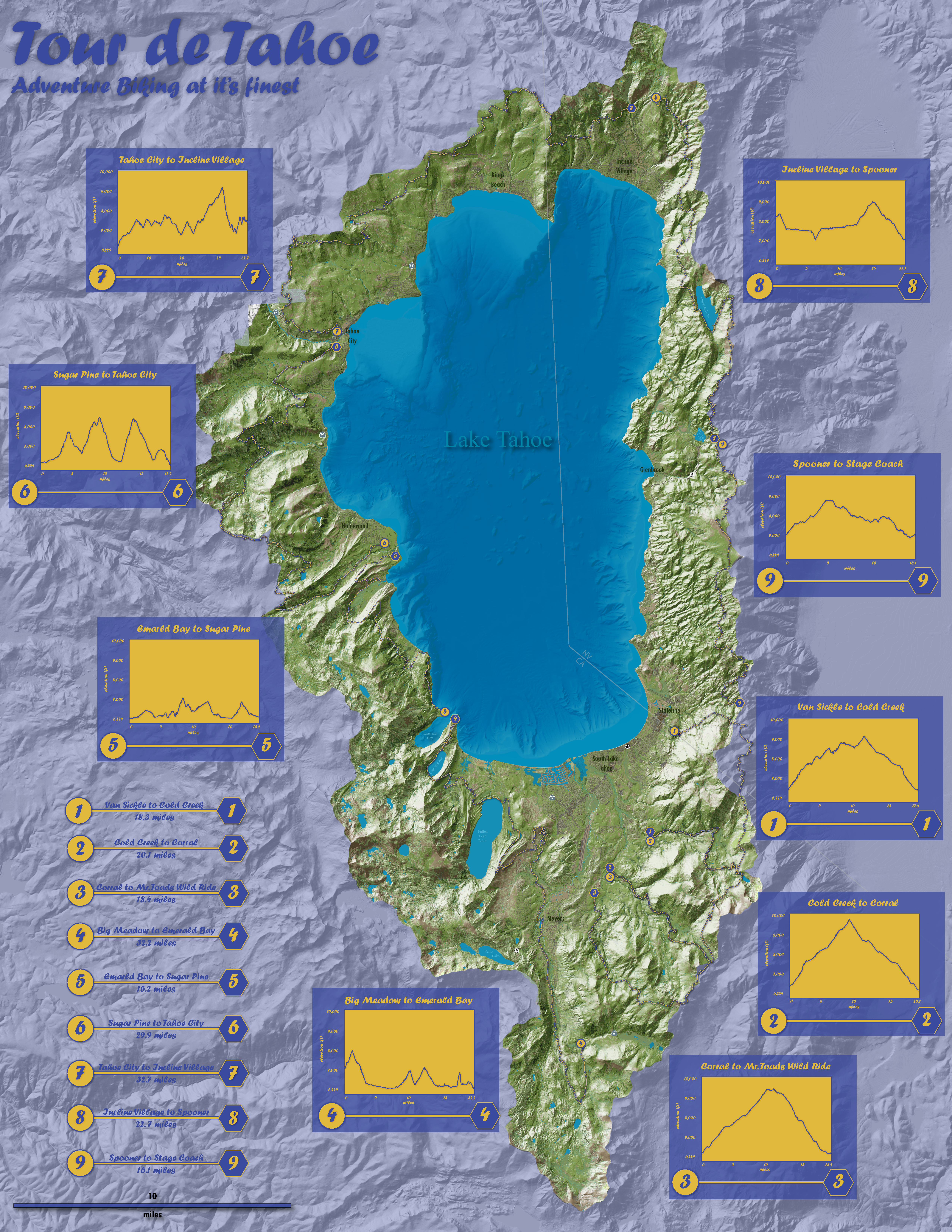
I live in Tahoe and love to mountain bike. This map started as a personal project — I wanted to visualize a route circumnavigating Lake Tahoe by singletrack and fire road, and a standard basemap didn't do the terrain justice.
The hillshade and terrain layers were generated in ArcGIS Pro using a high-resolution DEM. The shaded relief was refined and color-graded in Photoshop to bring out the topographic drama of the basin. The final graphic — including route annotation, typography, and layout — was assembled in Adobe Illustrator.
The result is a map that reads first as terrain art and second as a functional route reference. Click the image or the button above to view the full-resolution version.