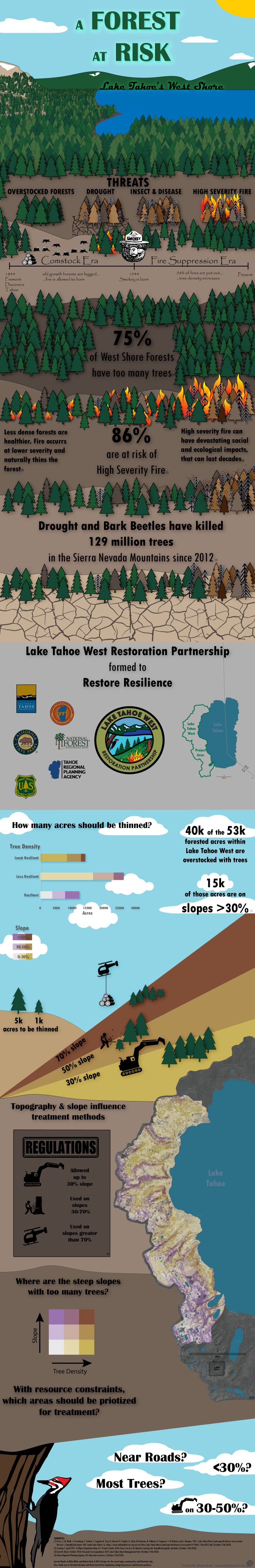
This infographic was created as part of TRPA's Lake Tahoe West restoration initiative — a large-scale forest management project on Tahoe's west shore designed to reduce wildfire risk and improve forest health.
The goal was to tell a clear, visual story for a public audience: what is the current condition of the forest, why does it matter, and what does restoration look like? The piece walks through stand density, fire risk indicators, historical fire suppression, and the ecological outcomes the project aims to achieve.
Data was sourced from TRPA's GIS databases and processed in ArcGIS Pro. The visual layout, chart design, and typography were assembled in Adobe Illustrator. Click the image or the button above to view the full-resolution version.