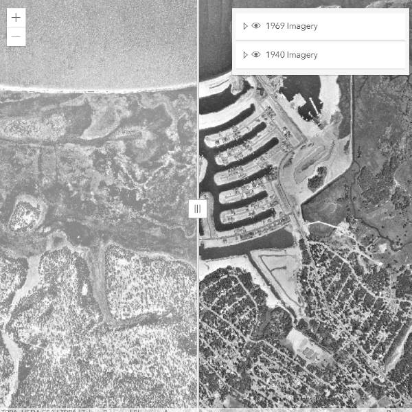
This interactive web map uses a split-screen swipe interface to overlay current high-resolution aerial imagery against historic photography of the Lake Tahoe region. Users can drag a divider to reveal and compare the two time periods side by side at any zoom level.
The tool was built to support TRPA's public outreach and environmental monitoring efforts — helping staff and stakeholders visualize land cover change, shoreline erosion, forest density shifts, and development patterns over time.